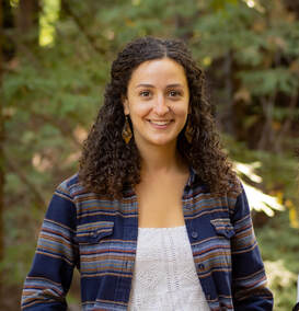
 The CRWC Board of Directors is proud to welcome their newest Member, Alix Soliman. Originally from Illinois, Alix earned her B.A. in environmental studies concentrated in international law and policy from Lewis & Clark College in Portland, OR. Passionate about effective science communication and community building, Alix works as the Communications & Outreach Coordinator at the Santa Lucia Conservancy where she oversees the Environmental Education Program, develops online and print resources, hosts naturalist events, builds partnerships, and manages digital media platforms. She comes to CRWC with over 7 years of experience in writing for, editing, and designing various newspapers, law school magazines, nonprofit websites and blogs. Dedicated to watershed conservation and fisheries management, she has studied fisheries policy and advocated for lower Snake River Dam removal to preserve salmon and steelhead runs in the Pacific Northwest. When she’s not working or volunteering, Alix can be found rock climbing, skiing, hiking, doing yoga, and reading.
0 Comments
 From the Monterey Herald From the Monterey Herald Have you heard about the Big Sur Land Trust's Carmel River Floodplain Restoration and Environmental Enhancement (FREE) Project? A recent article in the Monterey Herald discusses the project, it's history, and what we can look forward to.
From the Monterey Herald article: Located east of Highway 1 and south of the Carmel River, the site was formerly known as the Odello (East) Fields, where the Odello family transformed the floodplain into an agricultural field to grow artichokes. It was donated to the Big Sur Land Trust by Clint Eastwood and Margaret Eastwood and will serve as the construction site for the Carmel River Floodplain Restoration and Environmental Enhancement (Carmel River FREE) Project. The $45 million Carmel River FREE project aims to restore habitat and reduce flood risks for homes and businesses in the lower Carmel River watershed. Big Sur Land Trust’s project plans to create a series of new “conveyance” channels that allow the water to move through other pathways to reach the Carmel Lagoon and the ocean. Saunders [Big Sur Land Trust's Director of Conservation] explained that rather than remove the levee, the project will cut new notches into the levee to allow the water to stay in the channel but release it away from developed areas. To prevent flood waters from disrupting Highway 1, the project will dig underneath the highway and create a new opening for flood waters to flow through. Saunders explained that a detour road will be installed once construction starts on Highway 1 to prevent traffic delays. And to pay homage to the agricultural history of the land, the Big Sur Land Trust plans to create an agricultural preserve — with the dirt produced from the project — that is elevated to protect it from flooding. To read the full article, follow this link. California regulators from the Coastal Commission reviewed and unanimously approved a $140 million desalination plant on Thursday, offering a guideline for how the state can convert ocean water into drinking water amid the worst drought in 1,200 years.
Just five months ago, the same Coastal Commission had unanimously rejected a much larger and privately owned plant, citing environmental concerns. But the South Coast Water District's proposed Doheny Ocean Desalination Project, at one-tenth the size, won approval by the same 11-0 vote. The plan, expected to produce 5 million gallons of drinking water per day, enough for some 40,000 people, will serve a small water utility in Orange County, just south of Los Angeles. This approval sets precedent for other smaller-scale desalination plants in California, especially in regions that are faced with critical water shortages, such as the Marina-Monterey-Carmel region. Read more on the issue from Reuters by clicking this link. Upcoming Event: Second Regional Water Forum at Board of Supervisors meeting Sept 20, 2022, 1:30PM9/9/2022 On September 20, 2022 at 1:30pm, the Monterey County Board of Supervisors will hold its second regional water forum to address water supply issues facing Monterey County. The purpose of the regional water forum is to provide an overview of current efforts regarding water management and sustainability, and to initiate a comprehensive discussion on regional water supplies and solutions. The goal is to look broadly at what will be needed to ensure water security in Monterey County. An understanding of the larger regional water picture is important to forge a consensus approach for water agencies and County leaders.
The first regional water forum, held in March, provided a clear picture of how the regional water picture is now influenced by the Sustainable Groundwater Management Act’s required outcomes, particularly in over drafted subbasins. The second forum will provide opportunity for broader understanding of the portfolio of regional management actions and potential projects. As part of the forum agenda, we have invited special district water agencies and regulated utilities to share their perspectives on the following topics:
The Big Sur Land Trust announced this week that the beginning of Phase 1 construction of the Carmel River Floodplain Restoration and Environmental Enhancement Project (Carmel River FREE) has been postponed. This tough decision was made to avoid jeopardizing potential incoming funding from FEMA. FEMA is moving towards a $25.3M award for project construction, but requires a completed environmental assessment before breaking ground. For this reason, the project will pause until the assessment is complete, which is expected within a few months.
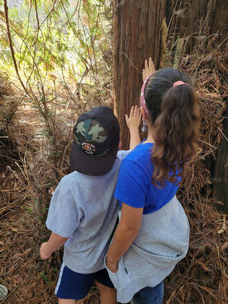
In the meantime, other project elements are continuing to move forward. This includes restoration, habitat management planning, project agreements, and final design of the causeway. Big Sur Land Trust is also propagating plant species such as black cottonwood, arroyo willow, creeping wildrye, and blue elderberry, all of which will be used for future floodplain restoration. Join the Big Sur Land Trust for a Carmel River FREE site visit on September 24th! More info here. The fourth annual California Wildlife Day took place on March 19th on a rainy day during the spring equinox. The event was hosted by the Carmel River Watershed Conservancy (CRWC) in partnership with the Monterey Peninsula Regional Parks District. The theme for the event was Connecting Communities: Wildlife and Watersheds, focusing on our stewardship of the land and how it affects the natural resources throughout California. This year’s event was held in a hybrid format, with the morning sessions taking place online and the afternoon events occurring in person at Garland Ranch Regional Park. The online speakers featured co-founder Lorin Letendre and former State Senator Bill Monning, followed by an Ohlone Rumsen blessing, and three panels to discuss wildlife, fire safe communities, and water resources. For a recording, please visit the Carmel River Watershed YouTube Channel. The afternoon sessions at Garland Ranch Regional Park began with a blessing led by Stephen Arevalo, a member of the Esselen Tribe of Monterey County. While rain fell, hands-on activities hosted by community partners and local student artwork were showcased in the Visitors’ Center. Antionio Balesteri and his birds of prey were a favorite of children and adults alike. Guests also participated in guided walks through Garland Ranch led by field experts. One of the walks called Nehi Mata, “Earth Walk,” was led by the Esselen Tribe of Monterey County and took visitors through the forest and alluvial plain to an ancient stone that indigenous peoples used for grinding acorns. At the native plant garden, the Ohlone Sisters, Carla Marie and Desiree Munoz, presented traditional songs and storytelling from the Costanoan Rumsen Carmel Tribe. CRWC is grateful to all of its partners and guests, in person and through our virtual community, who made this year’s California Wildlife Day such a special event. 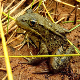 California Red-legged Frog, the largest native frog in the west. Endangered. via Santa Lucia Conservancy California Red-legged Frog, the largest native frog in the west. Endangered. via Santa Lucia Conservancy This spring the Cal State University Monterey Bay (CSUMB) Watershed Institute in partnership with CRWC has been updating and developing the Carmel River Watershed Health Report Card. The two new indicators are Aquatic Invasive Species and Wildfire Regime.
New indicators planned for 2022-23 development are: American Bullfrog Population, California Red-Legged Frog Population, Invasive Vegetation, and Historic and Predicted Flooding. The Aquatic Invasive Animal Species indicator studies New Zealand mudsnails, Striped bass, and Brown trout. This indicator assesses the portion of the watershed currently infested and the severity of the infestation. In later years this indicator will also include Crayfish. Throughout the summer the project will conduct surveys using environmental DNA where students will detect both invasive species such as the American bullfrog as well as native species like the California red-legged frog. The Wildfire Regime indicator focuses on the amount of time between fires and portions of the watershed within the expected fire range. Currently 29% of the watershed is within the expected wildfire frequency range. The project also updated the score for the River-Floodplain Connectivity indicator from 40 to 57 following restoration efforts to increase the connectivity between the Carmel River and the 100 year floodplain. CRWC is also creating a related story map exhibit for Palo Corona Regional Park visitor center. The story map, scheduled to go live this summer, will explain each indicator and how the public can get involved in the restoration work.  For decades, California American Water (CalAm) has been overdrafting the Carmel River, impacting the river’s health, surrounding ecosystem, and wildlife. To protect the river for future generations, a Cease and Desist Order (CDO) was enacted on December 31, 2021. The CDO will remain in place until the State Water Resources Control Board agrees to lift it. For the 2021-2022 water year, CalAm has legal rights to pull 4,110 acre-feet. The year after, it will shrink to 3,376 acre-feet of water.
Sections of the River near Rancho Cañada have run since the closure of the golf course, and are expected to further benefit from the reduced river pumping. The residents of Monterey County continue to be the most efficient water users in the state, utilizing an average of 57 gallons per person, per day. While regional conservation efforts and reduced water extraction may have improved flows on the river, the persisting drought continues to challenge the Peninsula’s water supply and the local wildlife. Carmel River fish counts have shown 0 adult steelhead migrating or spawning in the Cachagua tributary for the past two years, according to Brian LeNeve of the Carmel River Steelhead Association. According to the Monterey Peninsula Water Management District (MPWMD), aquifer storage recovery (ASR) efforts are continuing at lower than expected rates because they are highly drought and rainfall dependent. ASR injected 70 acre-feet this year, though the expected average is around 1,300 acre-feet per year. Despite this, MPWMD says water rationing is not expected to occur. 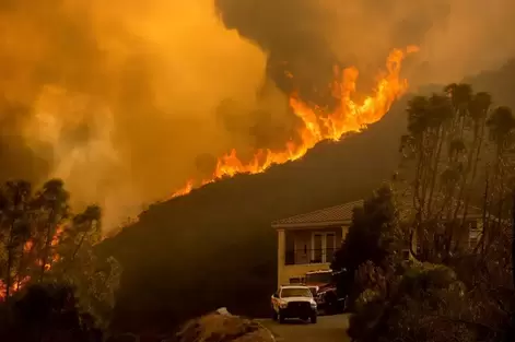 River Fire near Salinas, August 2021, via the Monterey Herald River Fire near Salinas, August 2021, via the Monterey Herald We have already seen an early start to fire season throughout California due to ongoing drought and historically low rainfall. Recent data shows January, February, and March were the driest first three months of the year in California history. These conditions have prompted CAL FIRE to suspend all burn permits in Monterey and Santa Cruz counties. It is imperative to take the necessary precautions to protect ourselves and others from the threat of wildfire.
On June 1st, the Monterey Fire Department began conducting wildland fire safety inspections for all properties within Monterey, Pacific Grove, Carmel-by-the-Sea, and Seaside. It is recommended that residents are proactive in maintaining the defensible space around their properties. For full information regarding defensible spaces, refer to the county guidelines. After inspections are complete, you can check the status of your property through the City of Monterey’s fire defensible space map. Monterey County recently added it’s 17th Firewise USA® community, Hacienda Carmel Community Association, located in Carmel-by-the-Sea. The Firewise Communities / USA Recognition Program “teaches people living within the Wildland-Urban Interface (WUI) how to adapt to living with wildfire by preparing for a fire before it occurs” (Firewise USA). Many of the communities within the county are located within high to very high fire hazard severity zones. There are currently insurance companies within California offering discounts for Firewise USA® communities who have taken the necessary precautions to prepare for the threat of wildfire. To learn more about how to become a Firewise community and the resources available, visit the National Fire Association webpage, or Fire Safe Council for Monterey County. Other ongoing wildfire management efforts include grant proposals from the Resource Conservation District for Monterey County (RDC) for fuel maintenance and fuel break work in Carmel Valley, and a join proposal from the RDC, CRWC and the Fire Safe Council for Monterey County to increase education and outreach, vegetation mapping, prescribed burning and other efforts in the Carmel River watershed and greater County area.
|

 RSS Feed

Carmel River Watershed Conservancy, 225 Crossroads Blvd Suite 322, Carmel, California 93923, United States
Carmelriverorg@gmail.com
Carmelriverorg@gmail.com
© Carmel River Watershed Conservancy. All rights reserved.