 The Monterey region has experienced an unusually wet winter, with recent heavy rains causing both positive and negative impacts on the region. Abundant rainfall has led to a rebound in fish populations, reduced wildfire risks, with promised benefits to the region’s aquifer storage and recovery (ASR) system. However, the rains have also resulted in localized flooding and infrastructure damage.
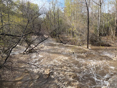
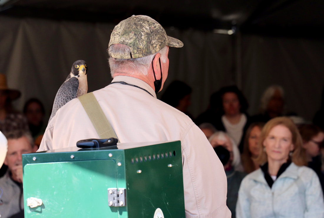
This winter’s increased rainfall has led to improvements in anadromous populations. The wet conditions have enabled salmon and trout to migrate upriver to spawn, providing an essential boost to their numbers. This resurgence will not only benefit the ecosystem but also the California salmon fishing industry (source: ABC10). Steve Park of the Carmel River Steelhead Association explained that this also helped the Carmel River watershed’s steelhead populations. However, even though the improved river flow supports the local steelhead population, their three year cycle between the ocean and the river means the wet conditions need to be sustained for several years in order to show longstanding improvements to the populations within our watershed. Another additional benefit of the heavy rains is that they have stimulated vegetation growth. While the abundant precipitation has led to more moisture in vegetation and soil, creating a less flammable environment (source: Fast Company), the rapid growth of new vegetation could also provide additional fuel for fires in the future. This shows how managing wildfires is complex and can be affected by various factors. Additionally, the heavy rains have positively impacted aquifer storage and recovery (ASR) in the Monterey area. ASR involves capturing excess surface water during wet periods, like this winter, and injecting it into the Seaside Groundwater Basin. This process improves water supply reliability and reduces dependence on imported water for the region (source: MPRPD). Jon Lear, Water Resources Division Manager with the Monterey Peninsula Water Management District, reports 1,341 Acre Feet of water have been injected as part of ASR this year. This included 13 Acre Feet per day at the two Santa Margarita Wells, which is the maximum permitted for the region. Two new wells will be built soon, which will allow for additional water to be recovered from future rain events. However, these historic rains have not come without damaging impacts. Local reports state the region has received well above the average annual rainfall, with some areas experiencing up to 150% of their typical precipitation (source: MC Weekly). Localized flooding and damage to infrastructure have been reported across the region. Roads and bridges have been affected, and some residents have been forced to evacuate their homes due to the risk of landslides. As the rains subside, communities and authorities must address these issues and prepare for future extreme weather events.
1 Comment
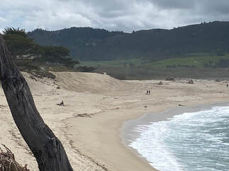 This past January high waves severely eroded the bluffs underlying Scenic Road at Carmel River State Beach, exposing a sewer line and causing the busy road to be closed. This had previously happened in 2013, making this a recurring issue. The County researched its short term options and decided to have the Carmel Area Wastewater District move the threatened sewer line out of harm’s way, which was quickly completed. They also decided to hire Granite Construction to repair the road and arm about 250 feet of the most severely eroded bluffs. They completed the job two weeks ahead of schedule and the road was reopened.
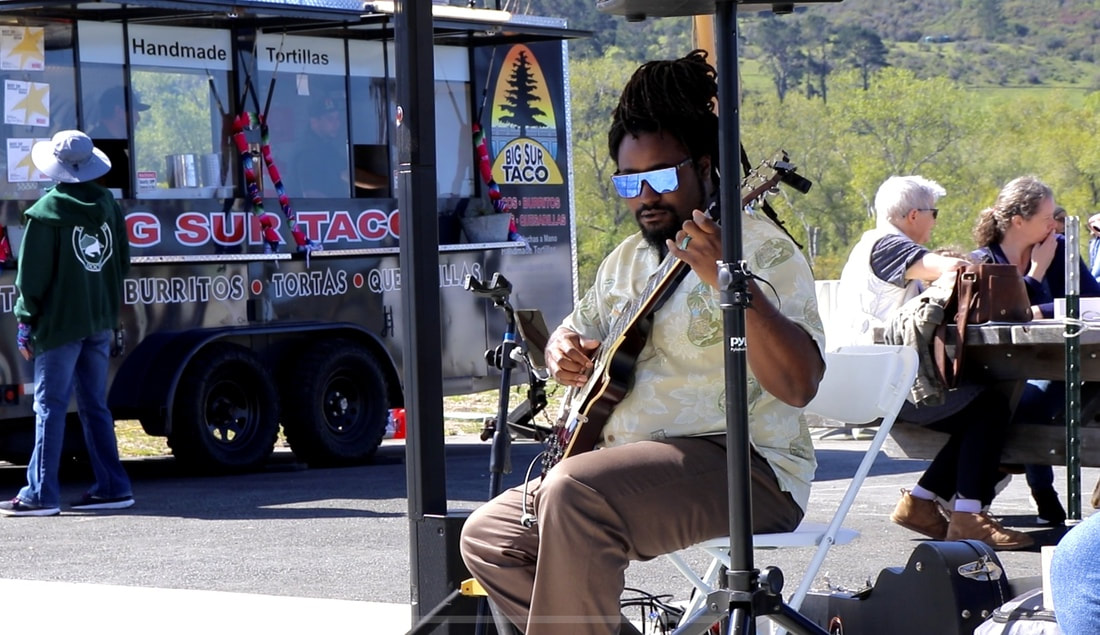
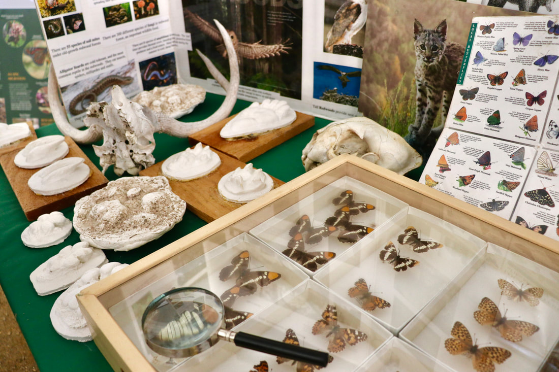
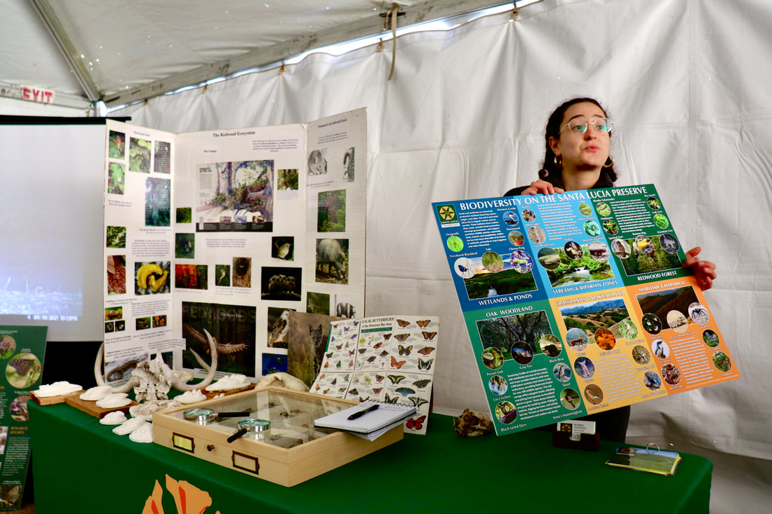
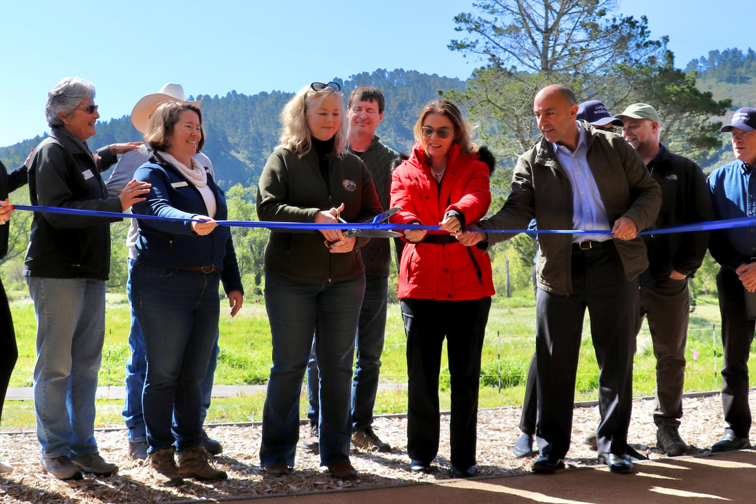
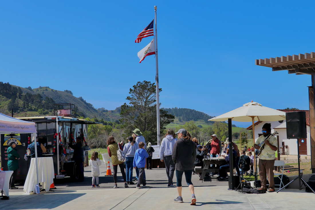
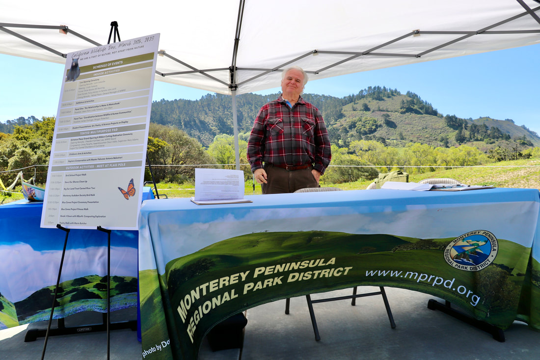
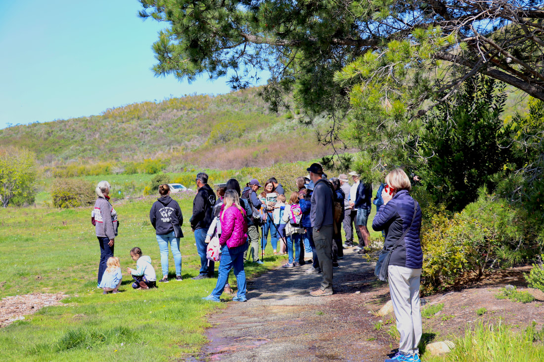
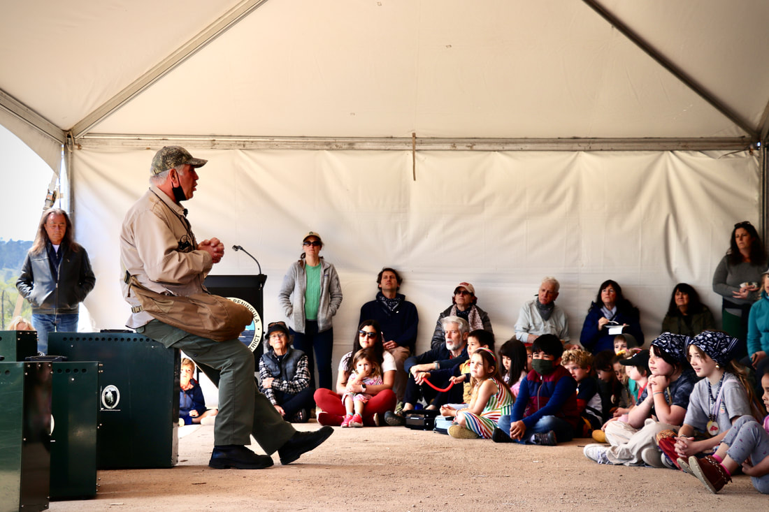
Now, the County needs to identify a long-term protection plan for another 750 feet of bluffs that are also in danger of severe erosion, and to obtain permits for its chosen project. The Conservancy (CRWC) has been assisting in this endeavor by working with State Senator Laird and his Chief Policy Advisor Kate Daniels to arrange a meeting with all the permitting agencies involved so that the recommended project has an optimal chance of being permitted. That productive meeting was held on April 27th and a follow-up meeting is being planned for later in May. CRWC (along with some Carmel Point residents) is also meeting regularly with the County’s Chief Administrator, Sonia de la Rosa, to help sustain the momentum for completing this project on schedule, and to offer our assistance in the approval process by the Board of Supervisors and all the permitting agencies. This improved process could serve as a model for future County projects that could benefit from input and active involvement by the residents that are directly affected by those projects. The Carmel River Watershed Conservancy (CRWC) recently launched an interactive digital story map of its Carmel River Watershed Health Report Card at the Monterey Peninsula Regional Park District Discovery Center, open Saturday and Sunday 10-4PM. This story map highlights several watershed health indicators and explains how they are calculated, accompanied by photos of our diverse wildlife and watershed. The story map will be updated with new indicators later this year. CRWC in partnership with the CSUMB Watershed Institute recently updated three previous indicators: River to Floodplain Connectivity, Unimpaired Streamflow and Tributary Streamflow. The two streamflow indicators were modified to be Dry-season Streamflow and Wet-season Streamflow. These are now calculated based on environmental flows, which takes into account both endangered aquatic species such as the steelhead trout and the rates of streamflow. The Wet-season streamflow indicator scored an 87 (Good), and the Dry-season indicator scored a 67 (Fair). The River to Floodplain Connectivity indicator is now calculated based on elevation models by comparing the floodplain height to twice the bankfull stage height (the height on the bank at which water begins to flood from the channel). If they are the same height then CRWC considered the river to be connected to the floodplain. This indicator scored a 32 (Severely Impacted), however, the Carmel River FREE project plans to widen parts of the floodplain to increase connectivity and reduce flooding in some parts of Carmel. CRWC and the CSU Monterey Bay Watershed Institute are working to create a new indicator that monitors threatened native species such as the California red-legged frog. Overall the Carmel River watershed is still classified as “fair” with a total score of 65. For more information, visit www.carmelriverwatershed.org. 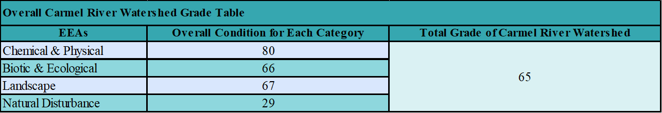 This year’s California Wildlife Day (CWD), held on March 26 at Palo Corona Regional Park in Carmel, returned fully in person after a three-year hiatus due to the pandemic. The event, co-sponsored by the Carmel River Watershed Conservancy (CRWC) and Monterey Peninsula Regional Park District (MPRPD), drew over 1,000 attendees throughout the day. The event featured indoor and outdoor activities, including remarks by local political leaders, a blessing from Linda Yamane, over 25 exhibitors, activities and nature walks for children and adults, student art and science projects, and panels featuring expert speakers on the topics of our relationship to watersheds and the intersection between wildlife and humans in the wildland urban interface. CRWC is deeply grateful to all who volunteered their time to make the event’s content and logistics a success. To watch the day’s panelists and check out examples of student art and science projects, please visit: https://cawildlifeday.net/cwd-2023-carmel-valley/. View our event video here! CRWC anticipates uploading more event photos and videos to the website later this month. The Carmel River Watershed Conservancy (CRWC) has a primary goal to increase the amount of water in the Carmel River, and to accomplish that we advocate for a three-pronged solution: (1) Diverting winter runoff from the Carmel River to the Seaside Basin to be utilized later as a water source (Aquifer Storage and Recovery). (2) Recycling stormwater and other wastewater to be thoroughly filtered and then reused as a second water source (Groundwater Replenishment). (3) Constructing a desalination plant to produce the rest of the water needed to supply the Monterey Peninsula's current and future water users. This ensures that we have a "drought proof" water source in times of extended drought. In October, California regulators from the Coastal Commission reviewed and unanimously approved a $140 million Doheny Ocean Desalination Project, offering a guideline for how the state can convert ocean water into drinking water amid the worst drought in 1,200 years. Read more about this project and how it will produce a reliable water source for South Orange County here: South Coast Water District's Desalination Project Will Provide a Local, Reliable Water Supply 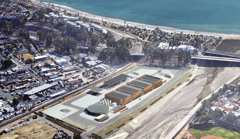 Artist rendering of the Doheny Ocean Desalination Project site (Orange Coast Magazine) 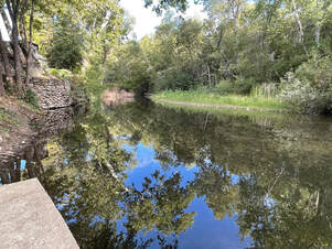 Lorin Letendre, CRWC President
The National Marine Fisheries Service (NMFS) published in 2013 a Recovery Program for our distinct population of steelhead trout named the South-Central Coast Steelhead (SCCS). The "grade" they gave the Carmel River steelhead recovery at that time was "Poor," as the numbers of adult steelhead in our river had declined to the low hundreds if even that many. NMFS stated that to delist (remove) our SCCS from the Threatened Species list a number of conditions would have to be met including: mean annual run size of 4,500 adults, adequate ocean conditions, density of spawning fish, and certain fish genetic histories in our river. We are far from reaching the target of annual steelhead runs of 4,500 adults, and the other required conditions are also unfavorable at this time. Many governmental agencies including NMFS, State Coastal Conservancy, and Monterey Peninsula Water Management District, as well as local non-profits such as Trout Unlimited, Carmel River Steelhead Association, and Carmel River Watershed Conservancy have worked tirelessly since the Recovery Plan in 2013 to help improve the conditions in the watershed conducive to steelhead recovery and much progress has been made to improve those conditions (see CRWC Watershed Health Report Card here). The Carmel River Task Force has been coordinating all these recovery efforts as well. Still, much remains to be done if we are to restore our historic steelhead population and eventually to remove the SCCS from the list of Threatened Species. Community support will be essential in achieving that goal. The recent spate of atmospheric river storms have reshaped and heavily damaged Carmel River State Beach and Lagoon and further undermined the bluffs underlying Scenic Road near Carmel Point. The County closed the stretch of Scenic Road above the beach due to exposure and potential destruction of the sewer line under Scenic Road, and is moving the sewer line away from the bluffs. County and other governmental officials met to decide how to install an emergency protective structure under Scenic Road along what little remained of the bluffs. Those bluffs have receded almost 30 feet since 2000 as a result of high wave action and river erosion. In the meantime, the County continues to work on a Revised EIR to develop a long-term solution to the bluff erosion and flooding risks for the homes along the Carmel River Lagoon. This EIR work began ten years ago and is still not complete. 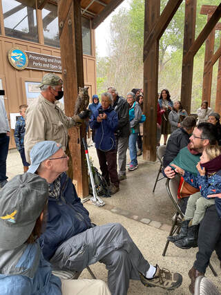 Join us for California Wildlife Day 2023 as we celebrate our state’s wildlife and open spaces! The Carmel River Watershed Conservancy and the Monterey Peninsula Regional Park District will host the annual CWD event on March 26, 2023, from 10AM - 3PM at Palo Corona Regional Park. This free and public event will include in-person programming such as live animal presentations, interactive informational booths, and discussion panels with speakers from across our region. Explore your own backyard with guided walks throughout the park grounds led by local experts (stay tuned for registration links on our website). Student artwork, poetry, and scientific posters will be on display in the youth art show. Students are encouraged to submit their original work to participate! Guidelines are linked here: Art and Poetry and Scientific Posters.
More information and a detailed agenda to come! Follow the CWD website for more. CRWC is working closely with CSUMB to produce an updated Watershed Health Report Card for the Carmel River Watershed. The Report Card is a public facing tool that uses 13 biological, chemical, and ecological indicators to track key watershed health metrics to identify priority restoration efforts. In the fall of 2022, significant modifications were made to the Report Card to improve and update watershed assessment practices. A new indicator for nutrients and pesticides was added, previous indicators were updated, and a new methodology for overall streamflow was implemented. Considering the Carmel River watershed’s proximity to Salinas, ‘Salad Bowl of the World’, and the vineyards in the Carmel Valley, it is imperative to measure the nutrients and pesticides within the watershed. Runoff from local agriculture, including these nutrients and pesticides, can have adverse effects on habitat and water quality. The measurement was completed by counting all known measured pesticides and nutrients within the watershed, then setting a threshold limit to each type. Any above the threshold were deemed as a failure and were averaged over the total of all pesticides and nutrients. The nutrients and pesticides indicator received a fair score at 74. This indicator will need to be continually monitored. Additionally, unimpaired streamflow and tributary flow indicators were combined to one indicator called the overall streamflow. Measurements for the river-floodplain connectivity indicator have been adapted to better capture river-floodplain connectivity. Ratios will be established to accurately compare and measure river-floodplain connectivity throughout the watershed. Current ratios and grading are still underway but will be present in the upcoming health report card. Now, the overall grade for the watershed is fair at 67, which is a C letter grade. This grade was obtained from weighing the four major categories, chemical and physical, biotic and ecological, landscape, and natural disturbance. The watershed health has improved but more conservation and management efforts are still needed. For more information, including past indicator scores, visit our website. 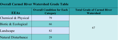 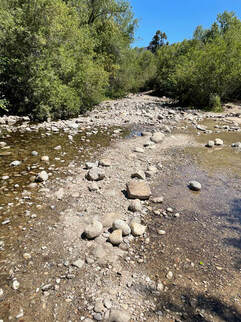 On November 17th, the Coastal Commission discussed and reviewed a permit application for a new desalination plant to be located in the Monterey Bay. With a vote of 8-2, the project was approved, despite environmental and equity concerns, which the water utility was required to address during this resubmittal. After 3 years of worsening drought and a moratorium on pumping water from the Carmel River, desalination brings an alternative source of drinking water to the Monterey Peninsula.
The new desalination plant will be built in the City of Marina, on the site of the old sand mining facility which is surrounded by dunes and coastal habitat. It is expected this plant would provide 4.8 million gallons of drinking water a day, equivalent to about 35% of the water supply for Monterey, Carmel, Pacific Grove, and other nearby communities. Coastal Commission staff reports that the water will cost approximately $6,000 an acre foot compared to $2,500 an acre foot at the Carlsbad desalination plant near San Diego. Local communities are concerned about the increased cost of water. The facility will suck saltwater from beneath the sea floor, treat it in the new facility, and discharge leftover brine through a pre-existing wastewater discharge two miles offshore in the waters of the Monterey Bay National Marine Sanctuary. In an effort to preserve local habitat and coastal access, CalAm will give the City of Marina $3M for a coastal access program. The company will also monitor dune, wetland, and vernal pool habitat, and prioritize purchasing coastal lands to preserve for mitigation. This desalination plant will relieve the pressure on the Carmel River, which was illegally pumped for decades, harming the watershed and endangered species habitat. The approval of this desalination plant follows precedent from another previously approved permit for a desalination plant in Doheny Beach, Orange County. After a nine year process, CalAm is one step closer to the reality of this Monterey Bay facility, with only a few more local and regional permitting challenges to face. The future of desalination as a steady water source for the Monterey Peninsula is looking extremely likely. |

 RSS Feed

Carmel River Watershed Conservancy, 225 Crossroads Blvd Suite 322, Carmel, California 93923, United States
Carmelriverorg@gmail.com
Carmelriverorg@gmail.com
© Carmel River Watershed Conservancy. All rights reserved.