
Vegetation Maps
Mapping Vegetation of the Watershed
A series of maps were developed in 2025 for the Carmel River Watershed Conservancy (CRWC) and the general public for wildfire resiliency planning and resource management. These maps display fine-scale vegetation, land use type, vegetation canopy height, and wildfire regime to support the development and implementation of projects to support wildfire, drought, and flooding resilience at the watershed level.
Vegetation Cover by type
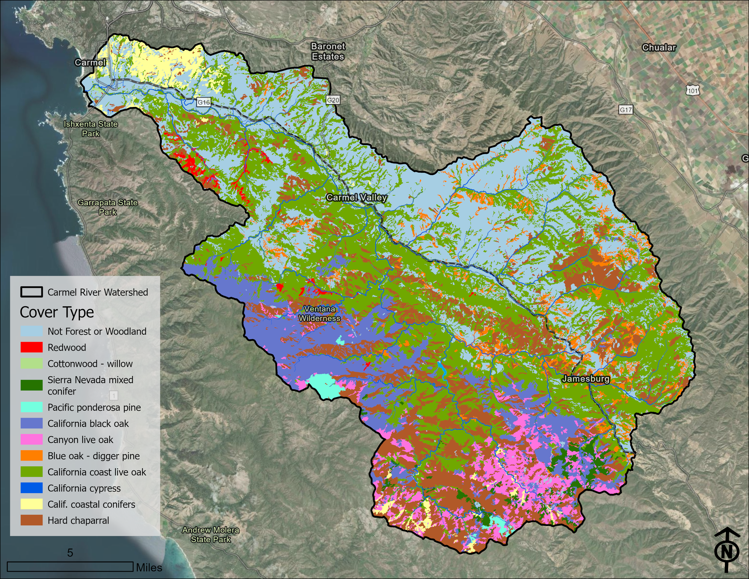
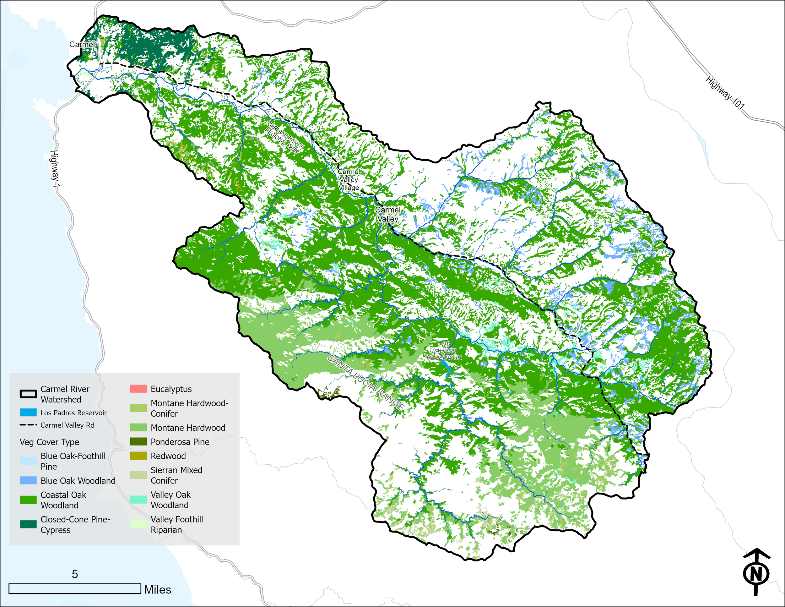
Across the Carmel River watershed, you’ll find a variety vegetation cover, broken down by type including forest and woodland, chaparral, and grassland. See below maps for additional vegetation cover by type.
Grassland Cover by type
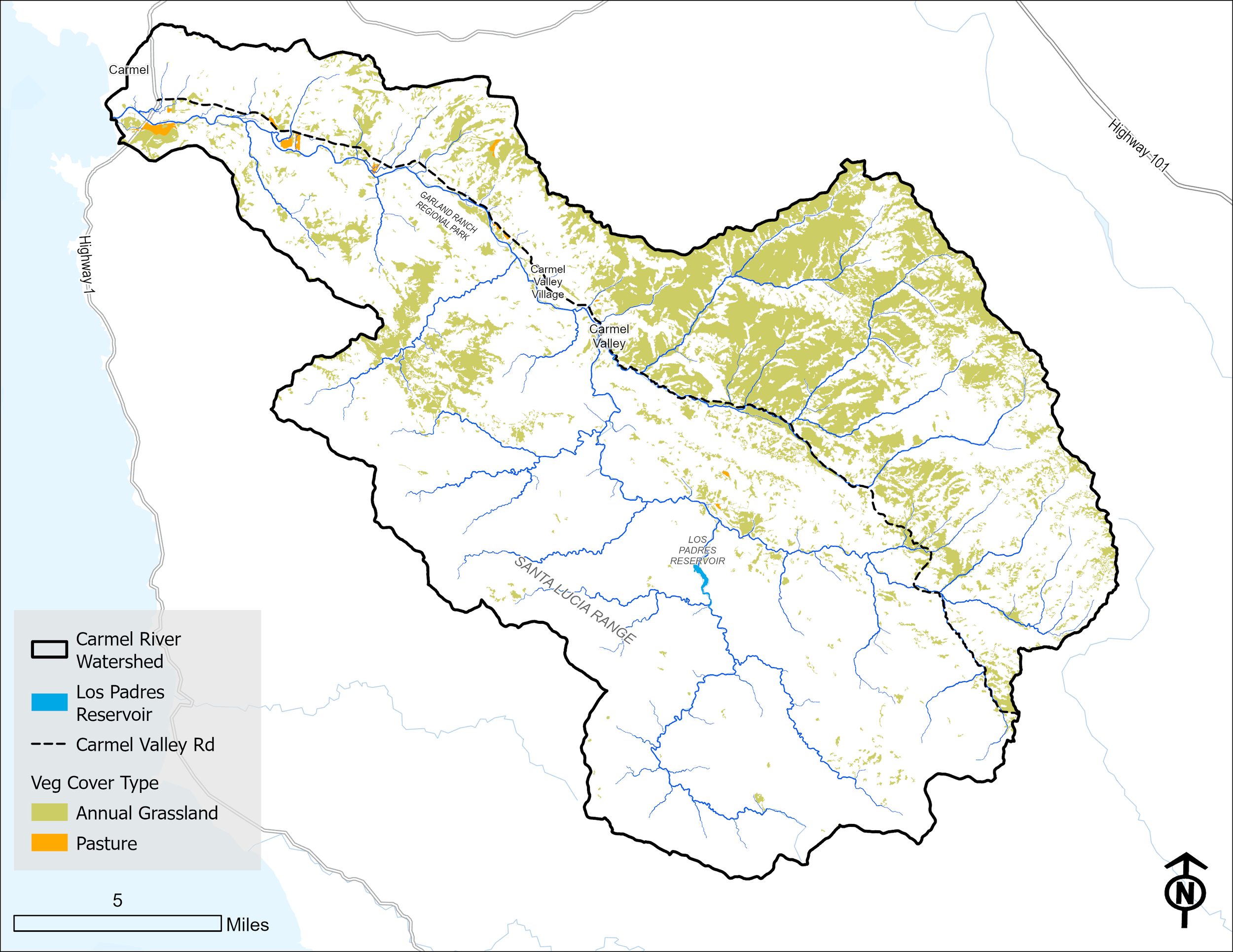
Grassland cover is the area of land vegetated by grasses and other herbaceous (non-woody) plants, measured by a canopy cover of less than 10%. Across the Carmel River watershed, grassland types include annual grassland or pastureland.
Shrubland Cover by type
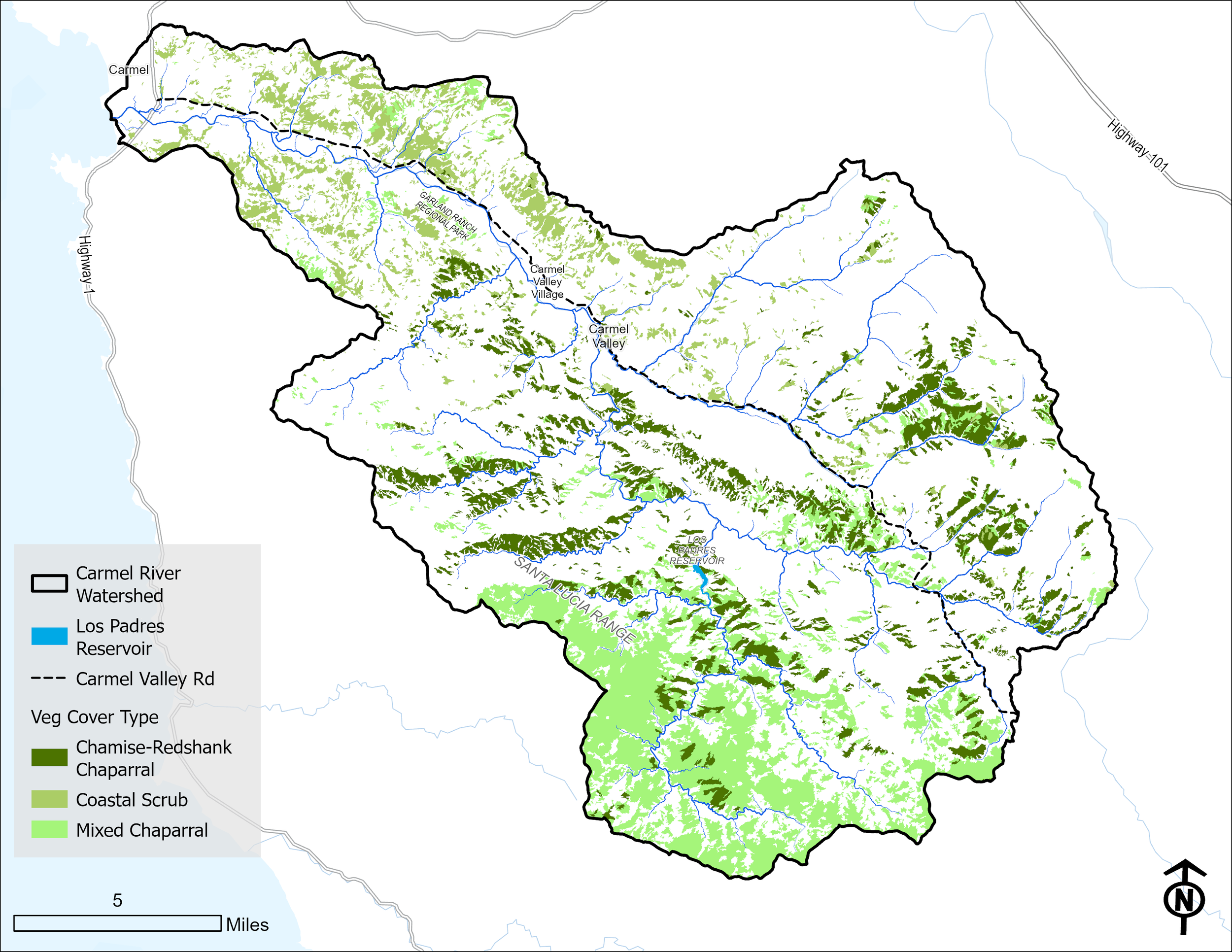
Shrubland is dominated by vegetation consisting of woody shrubs, brush, and low-statured plants. These plants are typically under 5 to 8 meters (16 to 26 feet) tall with a canopy cover usually exceeding 10% of total vegetation but lacking a dominant tree canopy. Across the Carmel River watershed, shrubland cover includes chamise-redshank chaparral, coastal scrub, and mixed chaparral.
Forest and Woodland Cover by type
Forest and woodland cover is the physical area of land occupied by trees, measured by a canopy cover of above 10%. Across the Carmel River watershed, you’ll find a variety tree cover, broken down by type (see legend).
Vegetation Canopy by Height
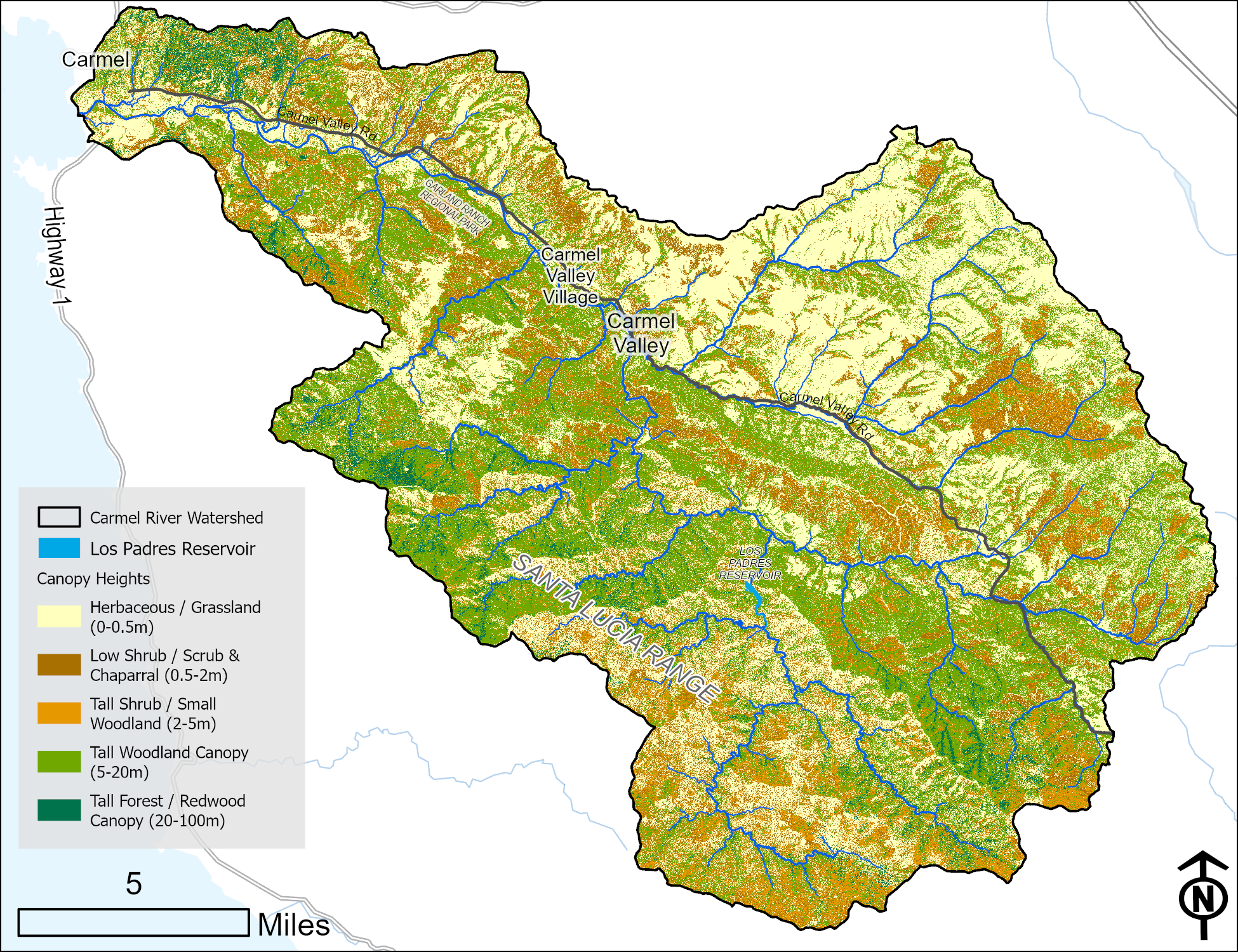
Vegetation canopy is broken down by height across the Carmel River watershed. Grassland is determined as being less than 0.5 meters. Low shrubland and scrub & chaparral are between 0.5 and 2 meters in height. Tall shrub and small woodland are between 2 and 5 meters. Tall woodland canopy is between 5 and 20 meters. Lastly, tall forest and redwood canopy are 20 meters and above.
This map was developed using of LIDAR data from VegCAMP from the Pacific Veg Map project, which is produced by Tukman Geospatial in partnership with the California Department of Fish and Wildlife’s VegCAMP program
Vegetation and Land Use by Type
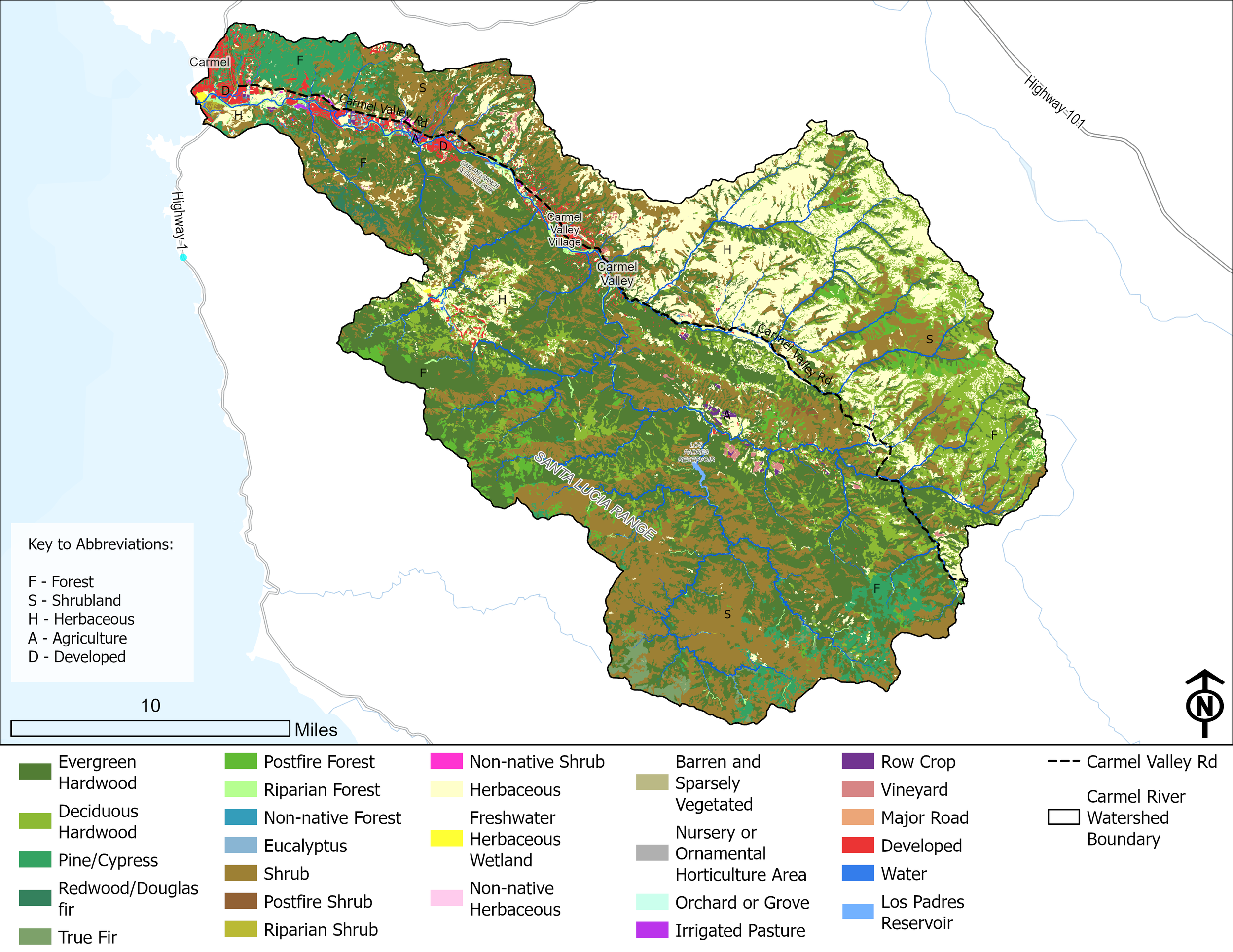
This map breaks down the type of vegetation and ground cover across the Carmel River Watershed as well as other land use types such as developed land or agricultural land. This also includes areas of non-native vegetation.
Historic Wildfire Regime
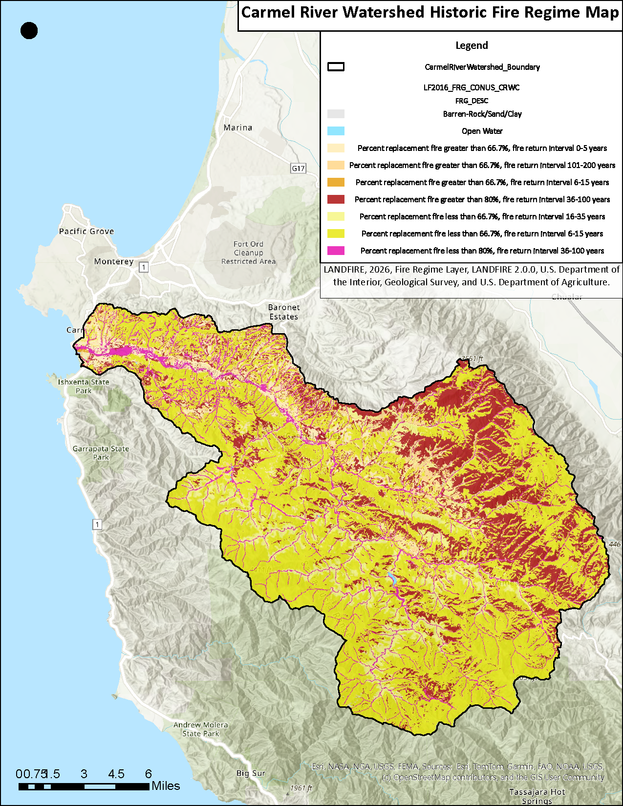
Historic wildfire varies across the Carmel River watershed ranging from a fire return interval from 0-5 years to every 100 years. This map characterizes the presumed historical fire regimes within landscapes prior to European colonization based on interactions between vegetation dynamics, fire spread, fire effects, and spatial context.
These maps are provided in partnership by the State Coastal Conservancy (SCC), Resource Conservation District of Monterey County (RCDMC), CSU Monterey Bay, and the Carmel River Watershed Conservancy (CRWC).
Special thanks to Rachel Rahtz with CSU Monterey Bay and Jamie Tuitele-Lewis and Brenna Fowler with RCDMC for producing these maps.
Check out the interactive GIS map for additional detail on vegetation cover, canopy heights, and wildfire regime across the watershed.